3D Gradient Descent in Python
Posted by Jack McKew on Wed 26 February 2020 in Python • Tagged with python, visualisation, generative • 40 min read
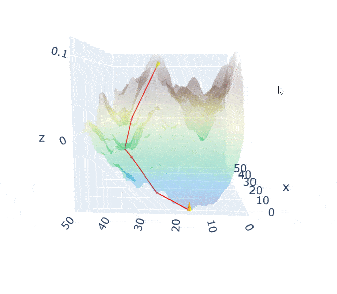
Visualising gradient descent in 3 dimensions
Building upon our terrain generator from the blog post: https://jackmckew.dev/3d-terrain-in-python.html, today we will implement a demonstration of how gradient descent behaves in 3 dimensions and produce an interactive visualisation similar to the terrain visualisation. Note that my understanding of gradient …
Continue reading